
|
|
I love that feeling of a new year and a fresh start. If I'm entirely honest 2018 was the worst year I have ever experienced for storms and night sky action, however there were still several spectacular events which compensated for the elemental drought such as the Ballyronan glace ice event, the Glenshane Pass and Rasharkin gorse fires and of course the Benbradagh prolonged stationary thunderstorm during a fantastic heat wave outbreak. These events made my year and generated memories and stories which will be brought up in conversations again and again. The entire second half of 2018 was a non-event, no storms, no aurora worth documenting and too many cloudy days and nights to count. I was glad when Christmas arrived, I unwrapped my new drone, the DJI Mavic 2 Pro, and began training with it in earnest. One of my goals for 2019 was to document convection and storms from an aerial perspective to a much greater extent than I have in the past to compliment my ground-based images and video so I was eagerly waiting for my first convective set-up.
Not long after 2019 arrived it felt like the tables had turned and things began to happen and with the new year came a pattern change and finally nature began to stir. The grey cloud and muck was cleared away to be replaced by an Arctic air mass which would introduce the first unstable skies of the season. A NWly flow with -40c air aloft, post-frontal troughing and 200+ CAPE with LIs of 0 to -1 would generate convection. Cold air overspreading a warmer ocean would be the breeding ground for cells so it looked like it would be a day of hail and snow showers with a slight risk of thunder. The CAPE was present all through the day and well into the night with N and NW coastal areas showing the best parameters, add to this the clean cold air mass and cells would have clear skies around them aiding greatly with photogenic potential. Lapse rates were excellent and soundings showed a low LCL meaning low cloud bases, furthermore charts indicated 20 knots of deep layer shear during daytime increasing to 50-60 knots of shear within the first 6km by 21.00 UT so things looked encouraging.
I decided that this would be my first storm chase of 2019, I prepped the van, bought snacks, tea, a water supply, wore appropriate warm clothing, topped up the diesel and hit the road to the north coast. The time was 11.00 UT, I planned to be there for midday when the greater unstable air would arrive at the coast, cells were already showing on radar to the NW and drifting over inland coastal areas due to the faster upper level flow. My mind set was optimistic, I wasn't expecting anything exceptional, this would be a day of simply being out in nature and enjoying what she presented. As I drove along the sea coast road I encountered a stunning primary and secondary rainbow, the bows were extremely vibrant and complete however I couldn't get pulled over to get a shot so I recorded footage on the Go Pro, not a bad start at all, that bow was actually very photogenic and would compliment any good Summer storm. I punched through a core of hailstones then arrived on Benone beach which would become my base of operations for the day.
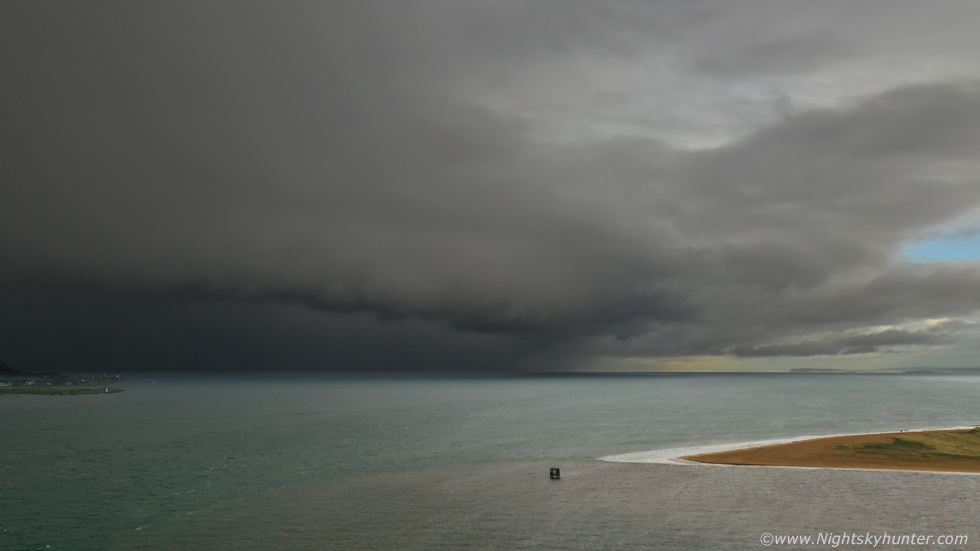 |
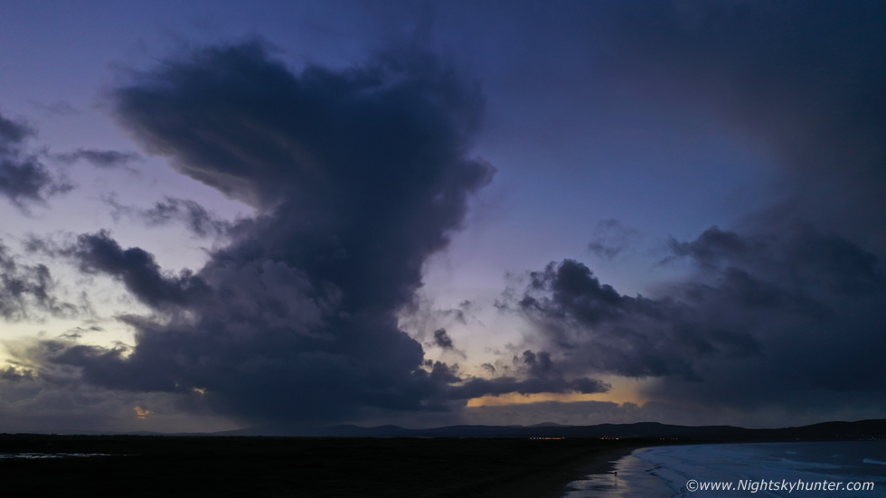
A period of rain and a coffee later and I had relocated to Magilligan Point to check out the area, amazingly my arrival coincided with the appearance of a large cell over Donegal which was crossing the ocean making a beeline for the north coast, I put the Mavic in the air to get a look and the higher I climbed the better the view became, at 100m altitude I hovered to get images. The cell had now sported a mean looking dark gust front on the leading edge marking the cell's outflow region, behind which was a wall of wind-driven rain and hailstones, sunlight lit up Magilligan Point and the Foyle which made for a dramatic scene. The Mavic had already captured its first storm scene of the season, my intentions were already manifesting and this was already better than anything I had expected this day, I was content so anything else would be a bonus. I landed just in time as the cell hit and I got soaked big time through the layers I was wearing before I made it back to the van, but I didn't care, the Mavic had already proven itself, it was born to capture storms.
 |
I went back to Benone beach where I met photographer Nigel McFarland, we had agreed to spend much of the day and after dark documenting any convection which presented itself worthy of shooting. If you have been following my chase reports on this website or my updates on youtube and on social media you will know that I have become passionate about time-lapse photography over the last few years. In some ways time-lapse has become my modus operandi and is the first thing I think of when I see a cool scene unfolding. I don't mean recording video and speeding it up later, I mean proper time-lapse using a DSLR to render short movie sequences of higher dynamic range which involves a massive amount of work, hundreds or even thousands of images taken on location and a lot of dedication and discipline and luck to get a sequence which works effectively. To get even 10-15 sec's of proper time-lapse is a lot of work, to get the same length at night time is even harder again, in short, you have to be completely focused on that task and have the ability to see the end result in your mind before you even set-up the camera.
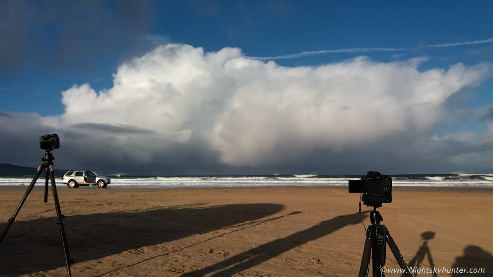
I have undertaken a great deal of time-lapse work over the years and often feature these in my 'end of year video presentations' on youtube. I promised myself that for 2019 I would acquire my finest storm time-lapses to date and hit it hard with my intention to produce my personal best presentation at the end of 2019 if nature is willing to help me out. On this day my goal was to get a few stills, try the drone out with convection and shoot new time-lapse material. This is what I done for the rest of the day, my camera worked very hard and I ended up with 2900 DSLR images which would later need rendered. Things kicked off by early afternoon, Nigel and I got treated to cell after cell so there was no shortage of convection to shoot. This one crossed the ocean dropping hail while moving left to right which became my first time-lapse target of the day, this is a phone snap of both our cameras in action. All we could hear was the flow of the ocean and the click click click of our shutters, those are great sounds in my books.
 |
As the DSLR shot time-lapse I decided to get the Mavic back in the air once again to shoot the cell from a different perspective, the first snap with the Hasselblad camera and 1 inch sensor out-performed my DSLR, the drone had captured it's second cell of the day, check out the small pileus cap on the main updraught. If you look carefully you can just about see that the updraught is leaning over somewhat to the right downwind due to the effects of speed shear.
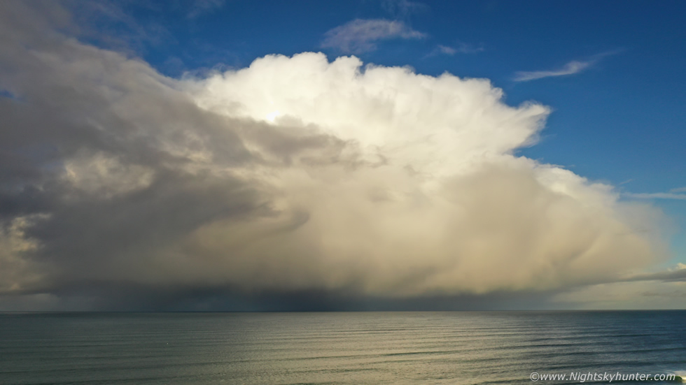 |
Compare this image to the previous and check out how rapidly this cell had evolved over a short period of time, this was a classic Winter Cumulonimbus or cb for short. For those that are not into their clouds cbs are the king of the clouds, they can come in many sizes with various shapes and slight variations in species traits. These are full of deep convective currents, air rises from the surface of the ocean in the form of an updraught which reaches its equilibrium level were it forms tower heads, its freezing up there so these water droplets turn to ice which in turn form into the classic anvil (incus) which becomes shaped by the upper level flow. The water droplets or hail become too heavy for the updraught to support so they fall to the surface as rain, this is the cell's downdraught, most cbs are composed with an updraught and downdraught, multicells may exhibit several of each at different stages of development.
When observing these clouds always keep a close eye on their bases, especially if the base is dry and well defined (rain free base), this is the area of the storm's inflow and where funnel clouds, waterspouts and tornadoes can manifest if other ingredients come together. Just such a set-up produced an outbreak of brief waterspouts over the north coast during the Winter of 2018, polar air mass cells dropped a waterspout which was captured from the Giant's Causeway and on the same day one lucky photographer captured two photogenic waterspouts in the same frame from Rathlin Island against a backdrop of falling hail curtains. Truly spectacular stuff indeed, and to think these vortex phenomena can happen in Winter during a set-up for snow may baffle some people, this is why coastal areas during the Winter months are the prime location to be for thunderstorms and why cells like this are always worth your time and admiration for you never know when they will reveal their secrets, or as Pecos Hank would say ''reveal their dangly bits''.
I shot drone stills then tried my first ever drone hyper-lapse thanks to guidance from Nigel who is always extremely knowledgeable on the subject of drones and aerial photography. The drone took one image every two seconds for a total of six seconds, between each shot it moved slightly on a pre-determined direction using the app called course lock and it turned out not too bad, you can see it on the video below. I landed the drone, recharged the batteries and returned to my DSLR.
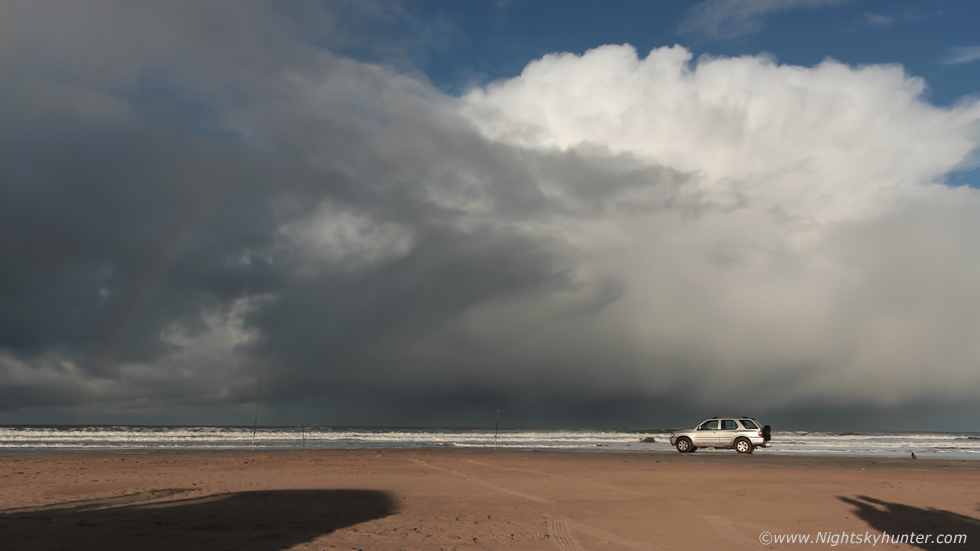 |
My DSLR had shot a lot of stills, this was the ground view of the same cell using the kit lens, it sure made for a good early season test subject. The jeep belonged to a fisherman who was here the entire day sea fishing.
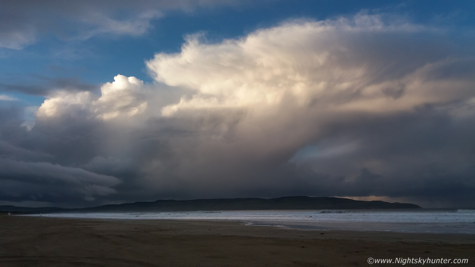 |
Before sunset another cell brewed upward over Donegal, you can see the updraught sheared to the right with an anvil spreading out aloft, if you viewed the anvil from above or by using satellite imagery it would take on the shape of an elongated oval or pancake. Behind the anvil to the west is a flanking line of new towers going up in response to the deep colder air arriving over the warm moist ocean, this cell was already exhibiting multi-cellular traits thanks to increasing wind shear as the day waned.
 |
Winter evening twilight, more cb development rapidly formed over the sea covering the horizon when the light was very atmospheric, the light from the setting sun was kissing the rear of the anvil. I shot a long DSLR time-lapse sequence then prepped the Mavic once more.
 |
The light was getting low, I switched the drone camera from auto to manual and dialed in my own settings and captured several low light stills. I then recorded video while flying over the surf while keeping the anvil in frame for the shot, it was a nice way to end the day.
 |
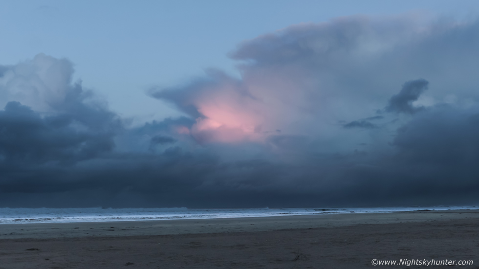
Somewhere between dusk and twilight a beautiful scene unfolded behind us to the W-NW. This single updraught shot upward and became a tall striking sight with a compact anvil on top. I used the drone once more to clear the sand dunes and get a better view. Quite a solid updraught and an impressive sight for a cold January convective scene, you can see the precip core falling over Lough Foyle, I was actually surprised there wasn't a rumble from this one.
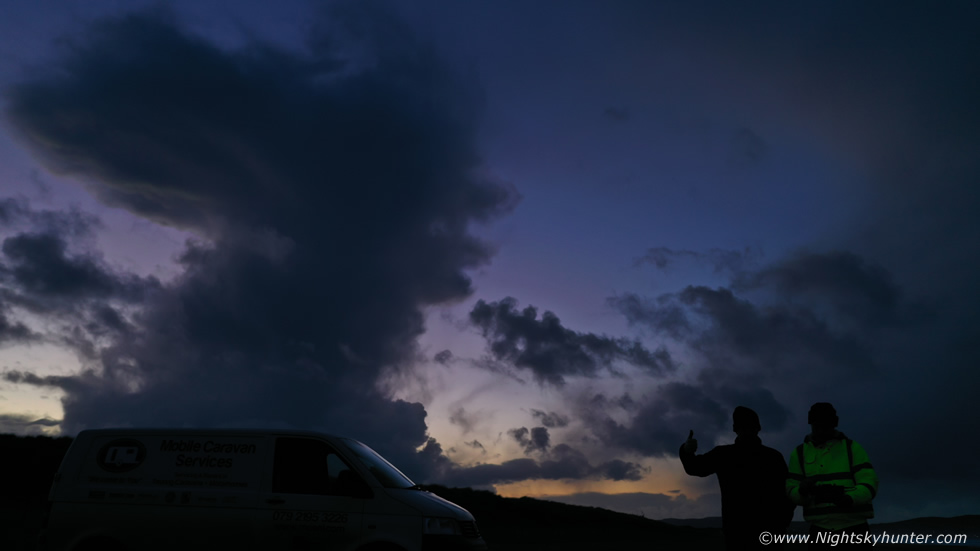 |
I had to include this memory shot of Nigel and I with the cell against the dusk sky in the last moody light of day, this was using the Mavic with the drone hovering approximately 30cm above the beach. Since the sky had been good to us we decided to stick around for a few more hours after dark to see what we could get. The CAPE was lowering during the night to perhaps 50-100 at best however the wind shear was increasing to 40 knots then later to 60 knots. Very often strong shear can compensate for lower CAPE, this applies to any time of year so with that said we returned to the vans, warmed up, got the cameras ready, had a brew and snack, checked radar and waited for darkness to fall.
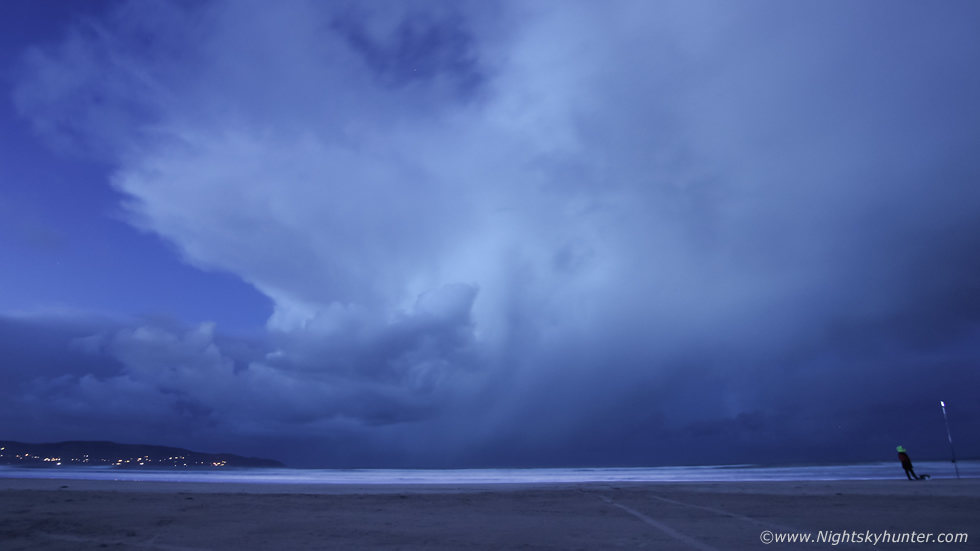 |
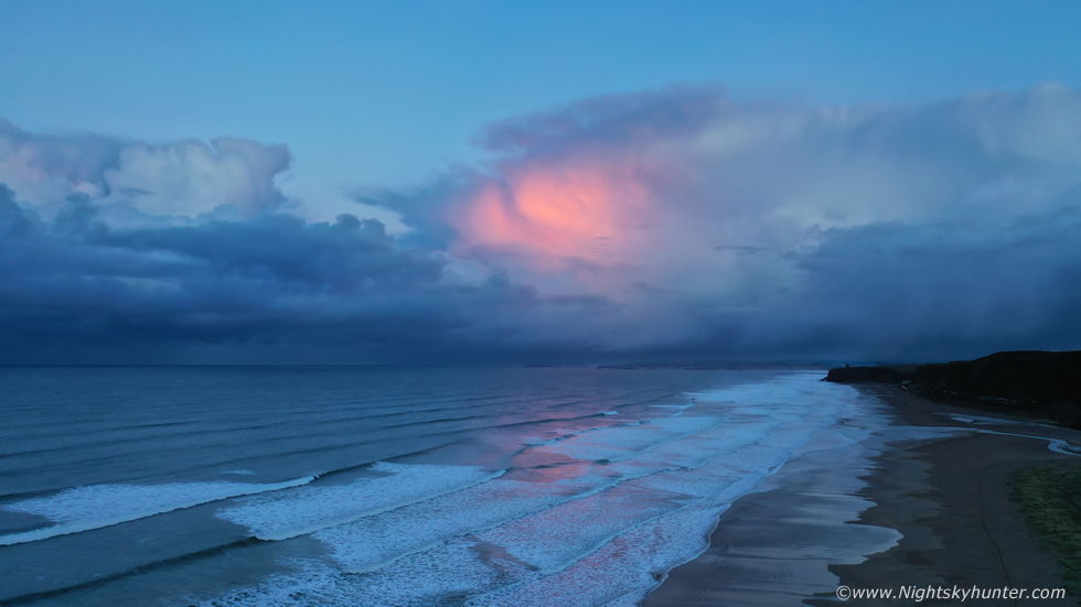
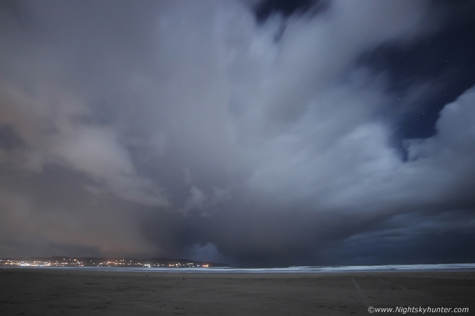
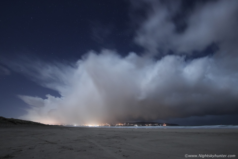
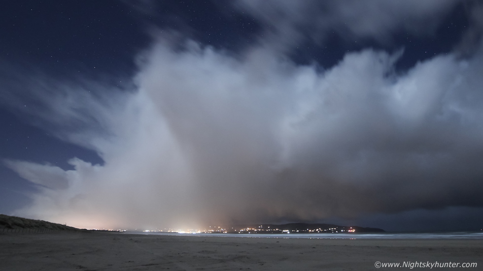
I'm glad we waited around, once a prolonged hail shower passed we got treated to this beautiful cell crossing the ocean before astronomical darkness. A combination of twilight light and a rising moon generated a very nice scene. Cell moving left to right, hail swaythe falling over the sea with anvil dominating the sky to the rear with a few early stars on view with the lights of Donegal below. Shooting 10mm wide angle for these, the fisherman was back out, we had become so accustomed to seeing him during all these hours now he was like a part of the scenery, no doubt he was thinking the same about us.
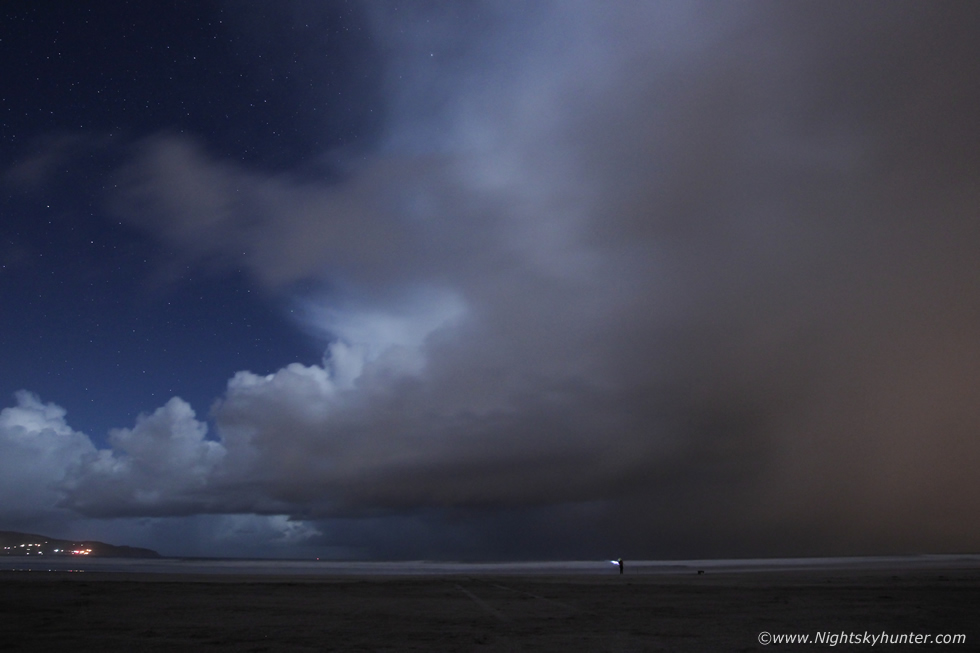 |
Full night time descended and the best structure of the chase formed in plain sight. The stars were out and the ascending first quarter moon cast it's light on this very photogenic cell. I had to use a short exposure to reduce motion blur however I would have loved to have the scene exposed brighter but with ISO limitations with the crop sensor I had to keep the ISO at 1600, this was 6 seconds, this was one of those times a full frame would have come in handy (or a brighter moon phase). The fisherman provided a great sense of scale for us, this was a textbook sheared Winter cell and a prize catch at night, this scene alone had made my trip as a lover of convective clouds.
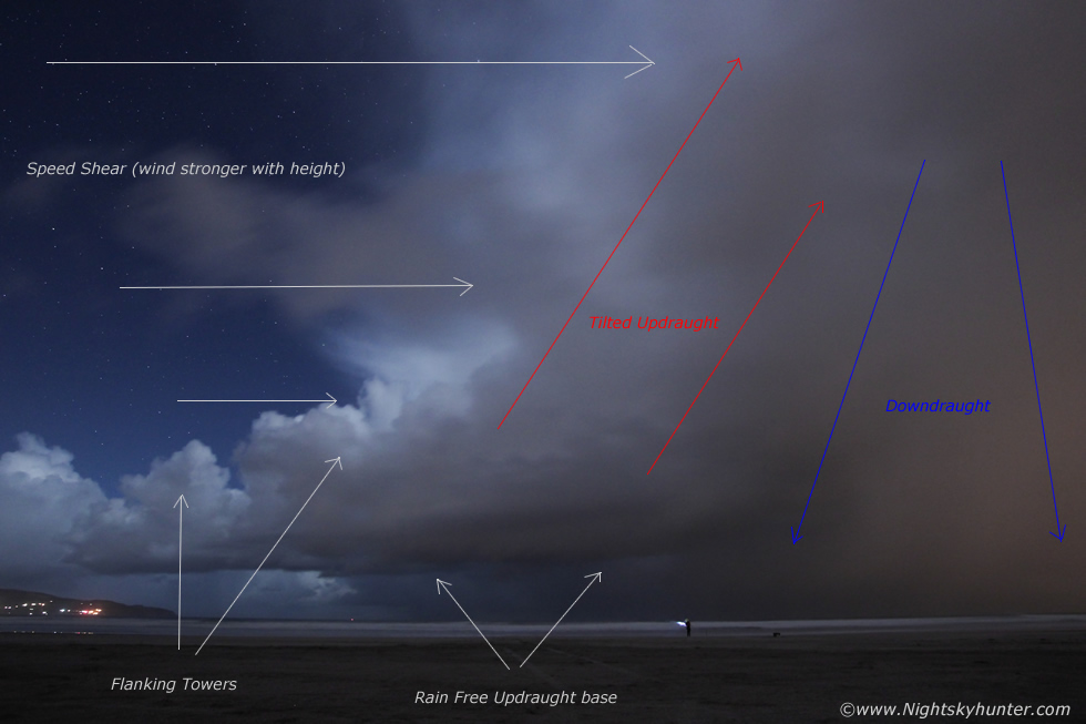 |
I annotated the image to help explain the processes going on within this pretty cell. Classic rain free updraught base (rfb), tilted updraught then downdraught displaced away from the base due to stronger shear aloft with flanking towers to the rear. This was a briefly organized low topped single cell, 50 knots or more of deep layer shear was now in play. If we had this kind of shear during Summer with modest CAPE we would be looking at storms with supercellular traits, but to capture a Winter version was a nice catch despite the weaker CAPE.
We got suddenly interrupted when a light appeared to our left, we watched until another appeared, then another, they seemed to hover in the sky, we then realized we were witnessing an unexpected flare display from a military exercise at Magilligan Point just over 1km down the beach. It was quite a sight and an unexpected treat like a fireworks display all to ourselves, I had never seen such a night flare display before so I used the 50mm F/1.8 lens and DSLR and recorded video of the show which went on for 15-20 min's. The fisherman came over for a chat, he was curious about our cameras and drones, once we explained we where documenting storm clouds he agreed that we were just as mad as he was so we all had a chuckle and got on well.
 |
Later this mean cell approached, we also noticed a shift in wind direction, earlier cells had been crossing the horizon so we had an oblique view of their structure, but with the wind veering more to the N the cells where blowing straight towards us. We watched this one grow from a moonlit tower into an anvil rather quickly, yet the core of the cell was on the far side of Donegal over the sea, however the winds aloft had blown the anvil over our heads here which indicated how strong the shear was, radar showed a large red core from this one similar in size to Lough Neagh. This was the base of the cell approaching at 10mm, the anvil is far overhead plotting out the stars, it now had two intense cores which looked an eerie sight in the subdued moonlight.
 |
This was soon followed by another cell which also exhibited multicell structure, you can see mammatus over Donegal, a line of new updraughts feeding in from the right and to the left was an extremely well defined hail core about to cross Lough Foyle. The scene looked very cool with stars in the sky, I began shooting a short time lapse even though I knew it would be on us before I had enough frames.
 |
Closer and cropped 16x9. Once it passed the sky cleared, there were reports of weak aurora activity from a solar wind stream so we took an exposure and captured our first aurora of 2019 as a faint green glow on the horizon with subtle red aloft. We didn't see it visually however the camera got it, the image wasn't worth posting here however it was nice to capture the aurora once again in the company of these passing cells. The cells began to weaken as the CAPE waned and after 12 hours of shooting on location we decided to call it a night.
DSLR footage of the night time flare exercise at Magilligan Point filmed with the 50mm lens, it's actually very relaxing to watch from a dark room.
Full time-lapse footage from the chase featuring phone footage, DSLR time-lapse, drone footage and even a quick drone hyperlapse of various cells we encountered throughout the day, it took my five days to render those sequences. Thanks very much for reading and with luck this Spring and Summer will be just as active as the start of 2019.
Martin McKenna